We had heard rumblings of a second waterfall in Yelapa and after doing some Googling we had some rough directions. While they did get us to the destination, they still left something to be desired, so here are hopefully very clear and easy to follow directions for anyone else hoping to enjoy swimming and playing in more gorgeous of the two waterfalls in Yelapa.
1. To start, begin on the tourist beach and head off behind the restaurants where you will find a cobblestone path that runs parallel to the river.
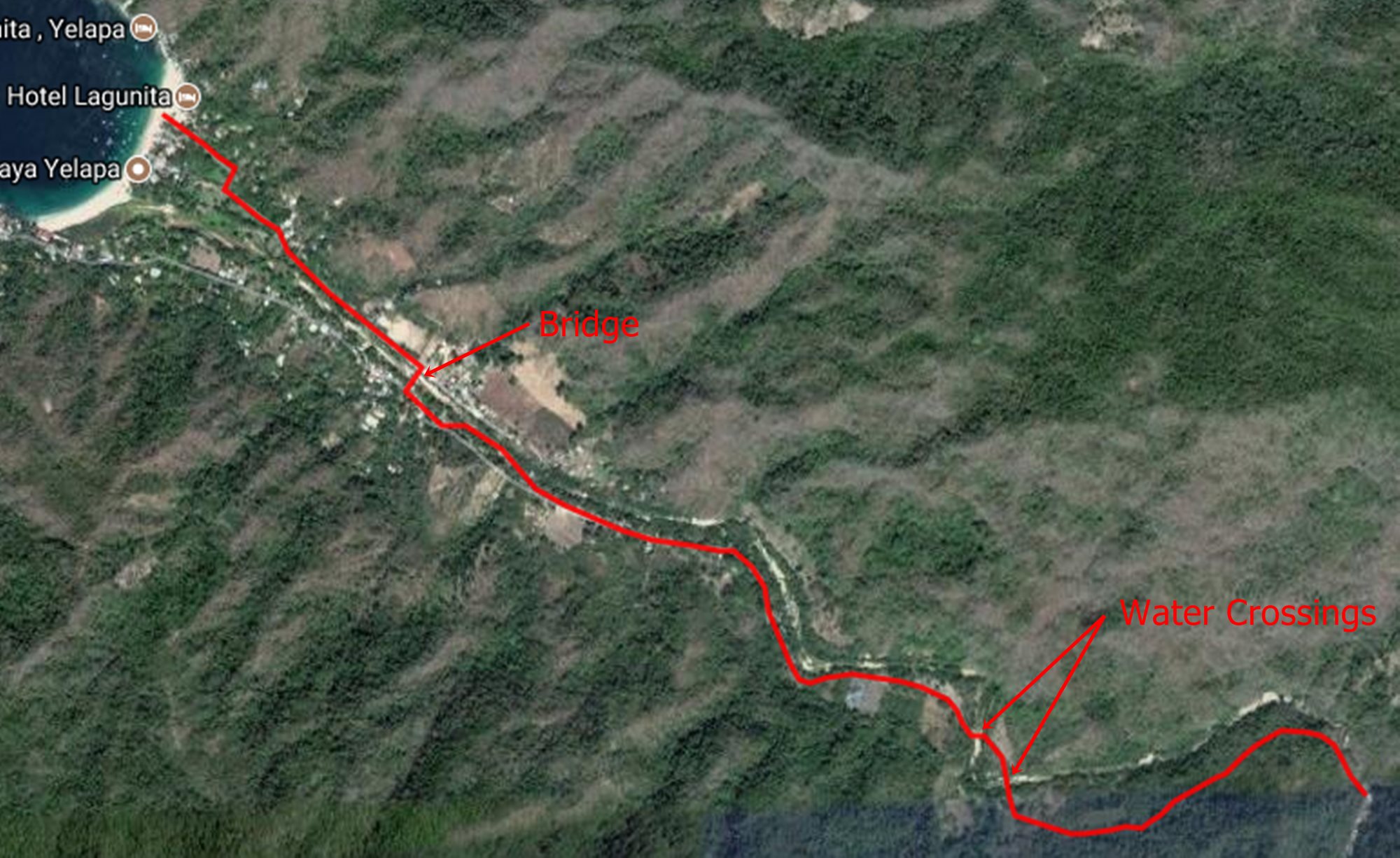
Map of the route
2. The cobblestone path will meander along for 400 meters or so before coming to some shops and tiendas. Look for a turquoise colored building on the right, just before it is a path to the bridge across the river. Take this bridge and then continue headed upstream parallel to the river. Note: If you see the Escuela (school) on the left you have gone too far.
3. The path will continue on with a mix of cobblestone and dirt before reaching a small pump/generator building after about 3,000 meters (from the beach). Just past the building is the first river crossing. Note: It is impossible to miss since the trail dead-ends into the river.
4. A short 100 meters later you will reach the second water crossing, which is equally obvious.
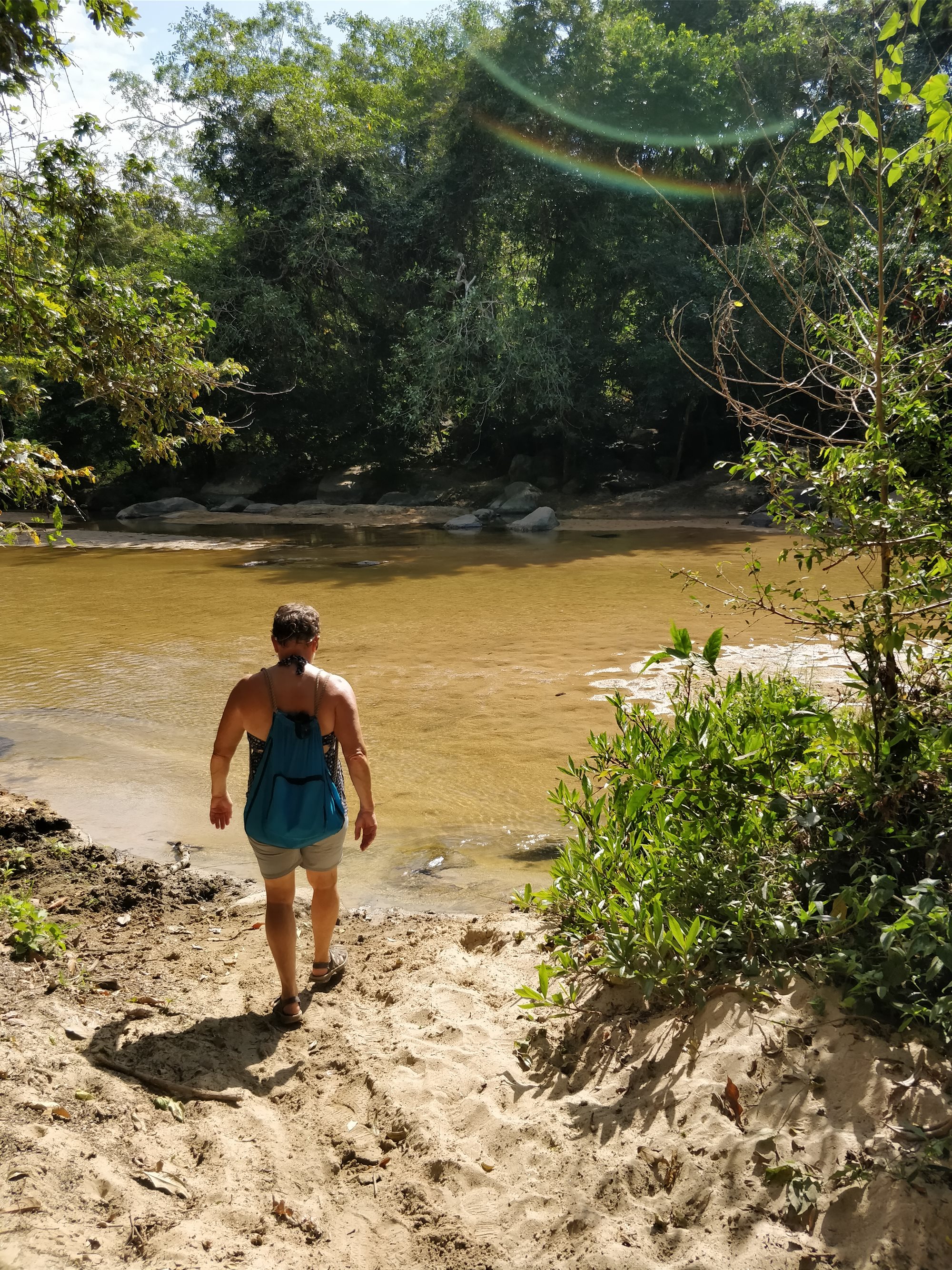
Second river crossing
5. Once across the river following the path to the left where pastures will be on both side of the trail. This path will be about 200 meters before reaching a gate that says “Waterfall” and “Cascadia”. Note: December 2017 the gate had been knocked down and was in pieces.
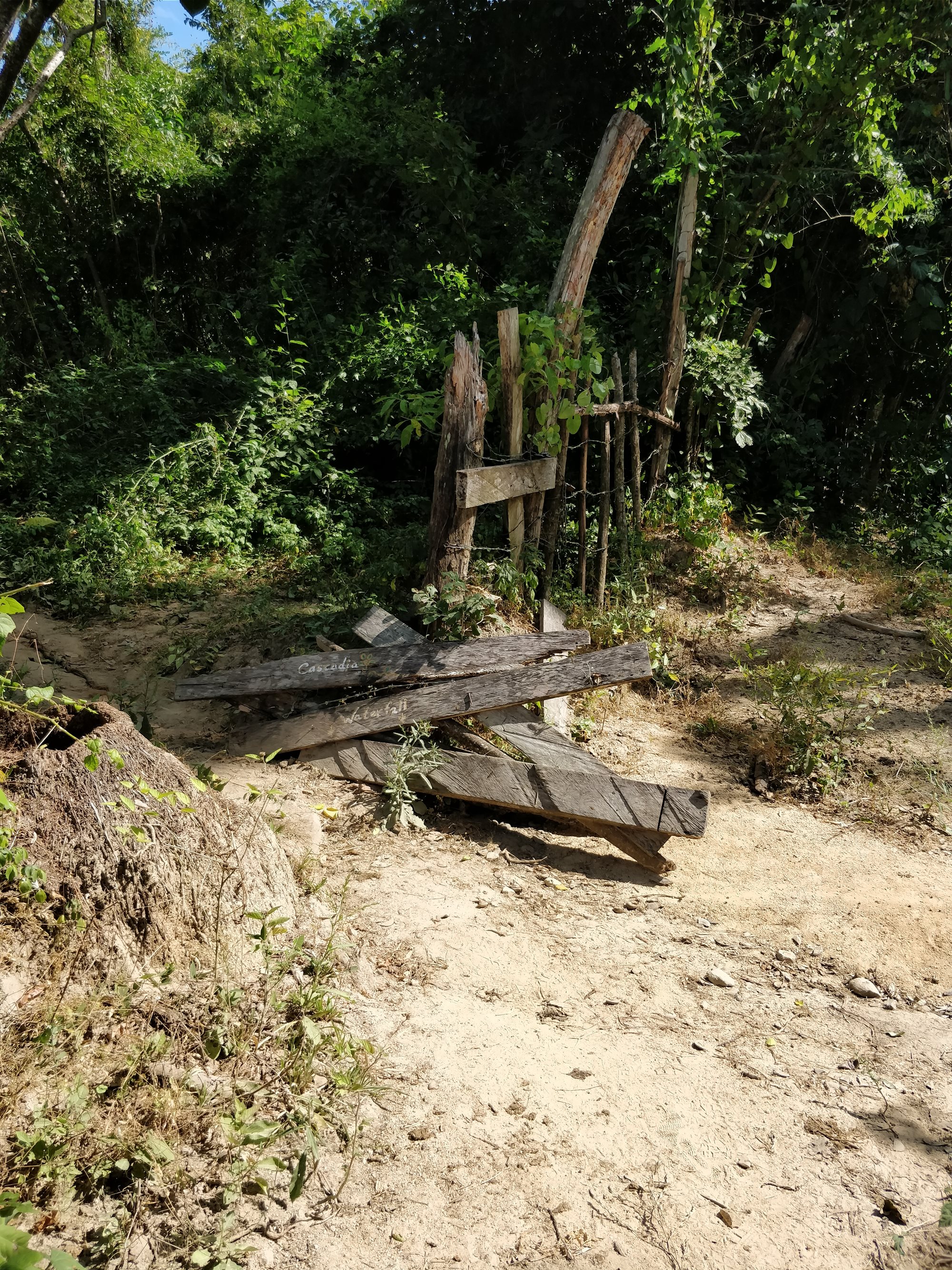
Gate
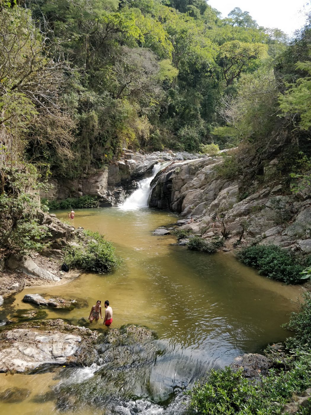
6. Pass through the gate, the path will get steeper and work its way towards the river. Stay to the right as the trail does split (the correct path is the one that looks more heavily traveled). The river will come into view (with a couple of spurs to get a nice scenic view) before the final rock scramble down to the pool below the falls.
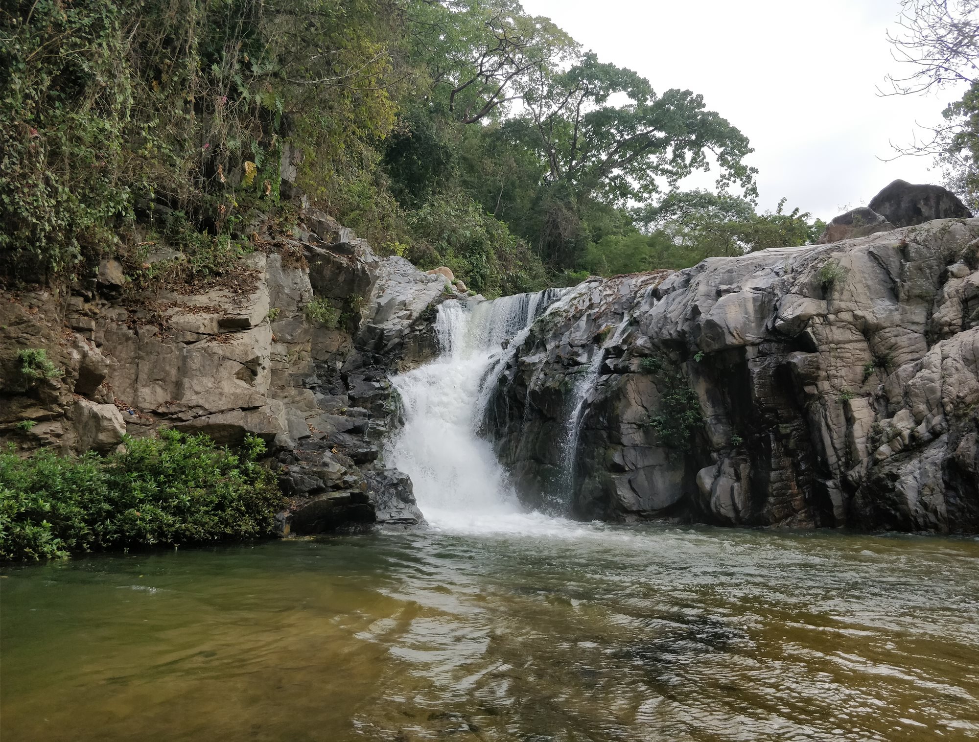
It is a great place for a picnic or to relax after a fairly easy hike which is approximately 4,000 meters (2.5 miles) from the beach. Travel time varies but hiking fast it is about 50 minutes while stopping to see the sights and pet the dogs can stretch it out to more than an hour and a half. Enjoy!
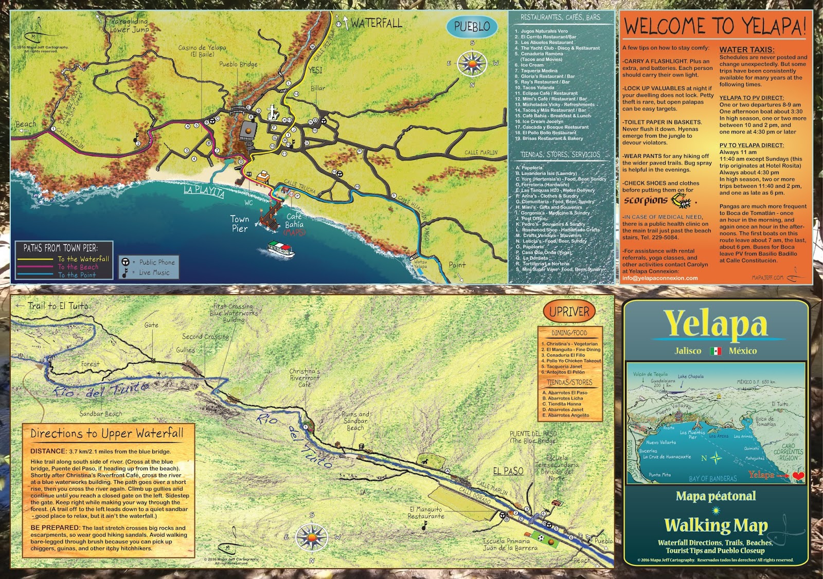
Map of Yelapa Village – Photo credit: Mapa Jeff Cartography
No Comments